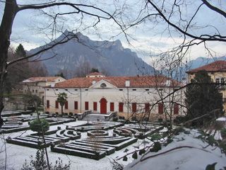
Stage Four Velo d’Astico – Tonezza del Cimone (Km 17)

Route description
Starting from the old Velo d’Astico railway station, which is now the Gran Passo Restaurant, continue along the old railway line as far as the old railway station in Arsiero; after the station go up a small ramp on the right and take a U-turn, continuing along Via Stazione, the road runs along the boundary of Villino delle Rose; go past the gate and the path becomes gravelly and begins to descend; at the main road, near the supermarket DiPiù, continue down towards the right along the tarmacked road against the flow of traffic. At the main road cross over the Posina bridge with Siderforgerossi to your left and at the roundabout by the pizzeria turn left onto Via Europa and continue as far as the bridge (Vecchio Ponte Schiri); cross the bridge and then cross the main road on the pedestrian crossing bearing left and following the signposts and the vie dell’Astico, a narrow route which goes past some houses and then immediately past the old Schiro quarry on the right; keep to the road (mostly tarmacked unfortunately) as far as the bridge Ponte Pria; go past the bridge on your left and follow the road on the right, going past the old Torri Medioevali (Medieval Towers) until the footbridge at Barcarola; cross the river Astico and the main road and then take the old Tonezza road, which is just over 6km and has 24 bends; the road begins to climb and after 300m, just before the signpost for Tonezza, take the path to the left and continue through to Contrà Suggi; go past it on the right and you come out again on the main road and following it to the left you reach the bend; leave the main road and follow the road marked Contrà Pierini; when you come to the pink house, go up the lane; keep to the right as far as Contrà Campana going past the restaurant “Il Cacciatore”; at the next restaurant, “Il Ciclamino”, turn left and take the narrow path which runs between two roads; when you come out turn right following directions for Villanova with the agriturismo “Il Canto del Gallo” on your right; after 200m take the path on your right and follow the waymarkings along the path until you reach “Villino dei Faggi”.
Route information
SP350 Valdastico from Trento: 1 km after Arsiero on the descent take the main road to the right; at the roundabout go straight on and take the next turning on the right; drive uphill 700m and you will see the old station
Hard climb from Barcarola to Tonezza: 700m elevation especially the last partFondo
Path along the River Astico and the last part in Tonezza
Tarmac on the old 24-bend Tonezza road and the stretch from Campana to Tonezza
- pace 4 kmph > 4 hours 45 minutes
- pace 6 kmph > 3 hours 20 minutes
- pace 8 kmph > 2 hours 25 minutes
- pace 18 kmph > 1 hour 10 minutes by bike
- SP350 Arsiero near the Villino delle Rose. Warning: heavy traffic
- SP350 Barcarola after the footbridge across the river Astico. Warning: heavy traffic
- old Tonezza road is closed to all traffic except residents. Watch out for cyclists as they come down
- main Tonezza road 400m after bend number 24 the path for Contrà Suggi. Open to traffic with no signposting of bike-pedestrian path
- main Tonezza road 200m after leaving the Suggi path at the fork in the road for Pierini. Open to traffic with no signposting of bike-pedestrian path
- Contrà Campana to Tonezza when leaving the Pierini path at the beginning of the Fogazzaro path
- centre of Tonezza from Villino dei Faggi to the square
- special care should be taken on all road junctions. Always follow the highway code and above all use common sense
Route map
Elevation profile


